Heights
Points on contours, index contours and points between two contours.
Reading a topographic map is a key geography skill: contour lines join points of the same height, and the closer together they are, the steeper the land. This free generator makes contour line worksheets with a different terrain every time, printed at true size, with an answer key.
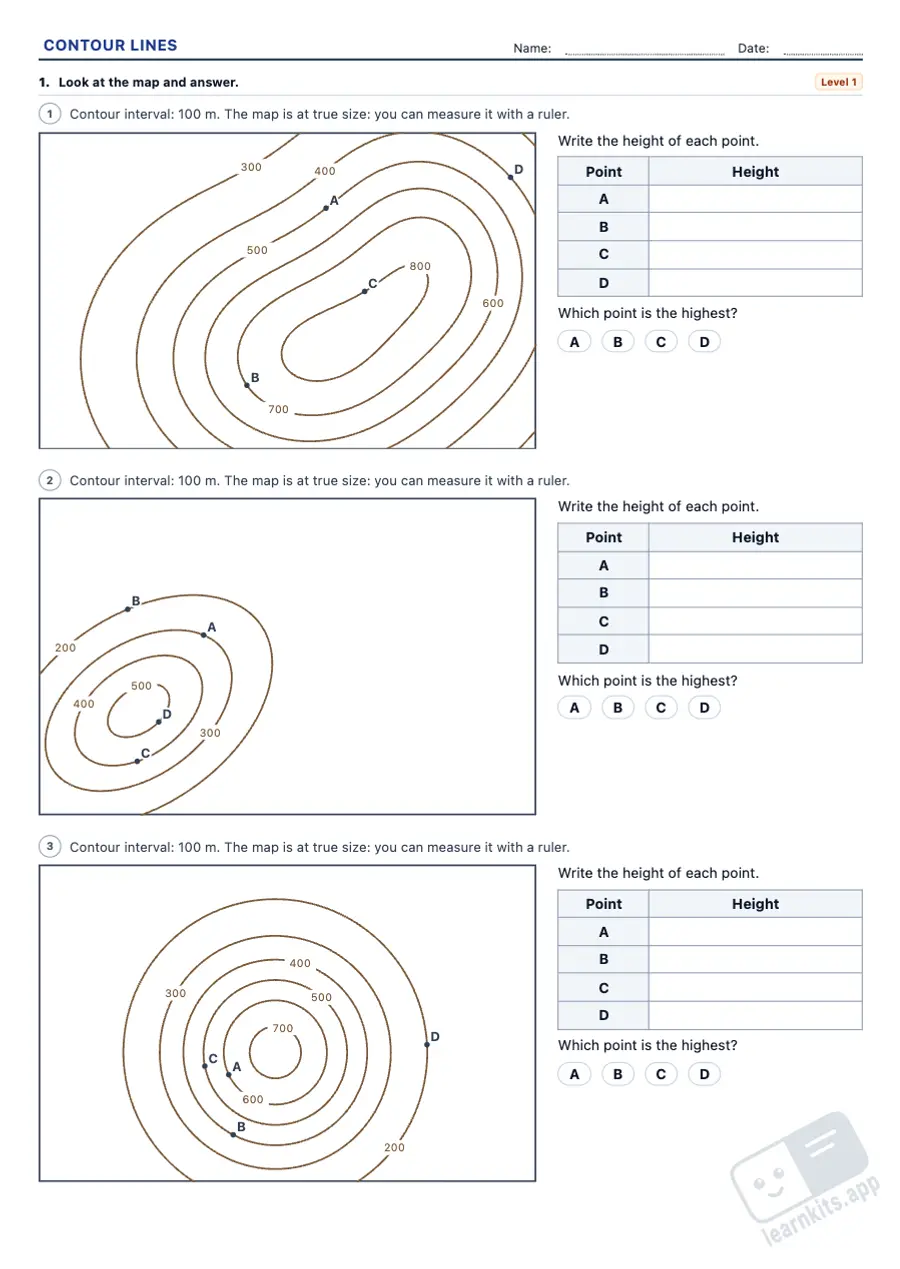 Student worksheet
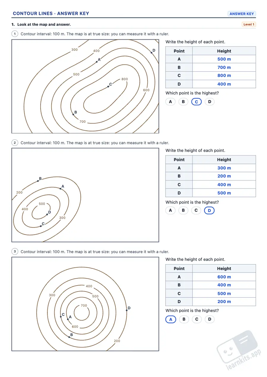 Answer key
Points on contours, index contours and points between two contours.
Compare sections: the more contours crossed in the same distance, the steeper.
A grid under the map, as long as the line X–Y, to transfer the crossings onto.
Real distances at 1:50 000 and 1:25 000, and the gradient as a percentage.
The map prints at its exact size, so it can be measured with a ruler.
The heights, the steepest section with its climb and the cross-section drawn.
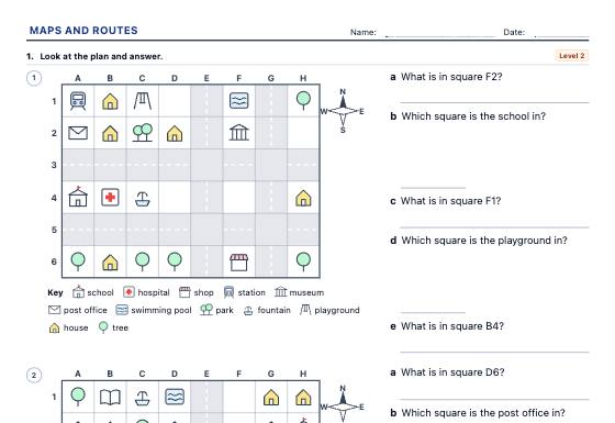
Map skills worksheets on random town plans with our own symbols: compass directions, grid references (B3), following and writing routes, left and right from someone else's point of view and the key, in three levels with an answer key.
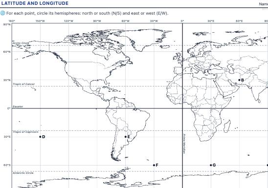
A world map with parallels and meridians to read and plot coordinates, identify hemispheres and find continents, oceans and cities from their latitude and longitude, with an answer key.
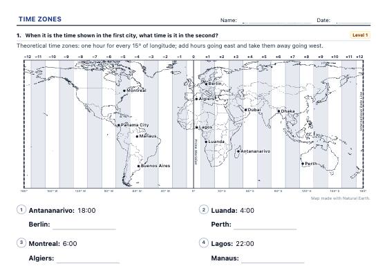
Time zones on a time zone map: a city's zone from its longitude, the time difference, what time it is in another city, a flight's local arrival time and the hours two offices share, with official time, half-hour zones and the International Date Line at level 3 and a worked answer key.